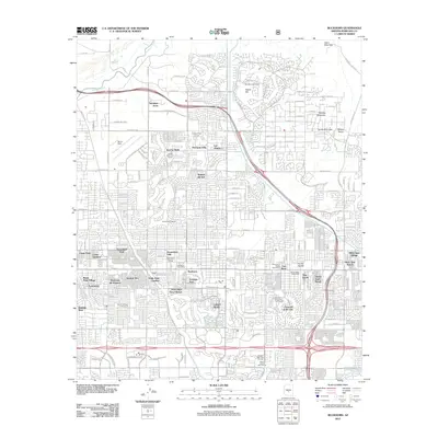
2011 Map of Buckhorn
USGS Topo · Published 2011About this map
The settlement of Buckhorn anchors this 2011 survey, showing a landscape defined by planned communities and specialized desert residential enclaves in Maricopa County. The development pattern is highly structured around irrigation and recreation, with the Southern Canal cutting across the northern reaches and numerous golf courses, such as Camelot Golf Course and the Sunland Village Golf Course, integrated into the suburban fabric. Significant landmarks include the Apache Post Office and the Mountain View Cemetery, while the varied topography of the area is represented by isolated peaks like Spook Hill and Thunder Mountain.
Find a feature on this map
56 named features on this map. Tap any name to fly to it.
Don’t see what you’re looking for? This feature index may not catch every label — zoom into the map to look around manually.
Map Details
Editions of this 2011 Buckhorn Map
This is the sole edition of this map. No revisions or reprints were ever made.
Other maps of this area

1904 · Camelback
USGS Topo · 1:62,500

1904 · Desert Well
USGS Topo · 1:62,500

1904 · Ft. McDowell
USGS Topo · 1:62,500

1906 · Camelsback
USGS Topo · 1:62,500

1906 · Ft. McDowell
USGS Topo · 1:62,500

1906 · Desert Well
USGS Topo · 1:62,500

1913 · Mesa
USGS Topo · 1:62,500

1915 · Mesa
USGS Topo · 1:62,500

1930 · Cave Creek
USGS Topo · 1:125,000

1939 · Cave Creek
USGS Topo · 1:125,000