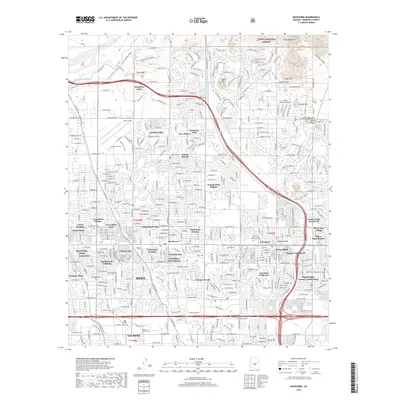
2018 Map of Buckhorn
USGS Topo · Published 2018About this map
Mesa and its expanding eastern neighborhoods are defined here by a complex web of planned communities and irrigation infrastructure. The northern reaches are shaped by the Salt River and the Southern Canal, while the Central Arizona Project Aqueduct cuts a distinctive diagonal path toward the southeast. This landscape reflects the post-war suburban transformation of the Salt River Valley, characterized by numerous age-restricted and vacation-oriented developments such as Leisure World, Dreamland Villa, and Venture Out.
Find a feature on this map
64 named features on this map. Tap any name to fly to it.
Don’t see what you’re looking for? This feature index may not catch every label — zoom into the map to look around manually.
Map Details
Editions of this 2018 Buckhorn Map
This is the sole edition of this map. No revisions or reprints were ever made.
Other maps of this area

1904 · Camelback
USGS Topo · 1:62,500

1904 · Desert Well
USGS Topo · 1:62,500

1904 · Ft. McDowell
USGS Topo · 1:62,500

1906 · Camelsback
USGS Topo · 1:62,500

1906 · Ft. McDowell
USGS Topo · 1:62,500

1906 · Desert Well
USGS Topo · 1:62,500

1913 · Mesa
USGS Topo · 1:62,500

1915 · Mesa
USGS Topo · 1:62,500

1930 · Cave Creek
USGS Topo · 1:125,000

1939 · Cave Creek
USGS Topo · 1:125,000