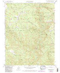
1947 Map of Buckhorn Peak
USGS Topo · Published 1987About this map
Stanislaus National Forest terrain dominates this mid-century survey of the California gold country, revealing a landscape defined by deep gulches and significant mineral extraction. The intricate hydrology of the North Fork Merced River and its tributaries, such as Dutch Creek and Maxwell Creek, provided the necessary water for the numerous mining operations scattered across the ridges. Mining activity is heavily documented through sites like the Red Cloud Mine, Bondurant Mine, and the Marble Spring Mine, which are situated among prominent heights like Jackass Mountain and Texas Hill. Small settlements and utility outposts, including Date Flat, Cat Town, and the McDiarmid Guard Sta, appear alongside the historic Ponderosa Way, reflecting the era's forest management and lingering gold-rush era settlement patterns. The presence of Bower Cave and the Bull Creek Sch adds layers of local social and geological history to this Mariposa County landscape.
Find a feature on this map
39 named features on this map. Tap any name to fly to it.
Don’t see what you’re looking for? This feature index may not catch every label — zoom into the map to look around manually.
Map Details
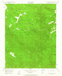
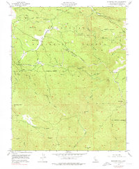
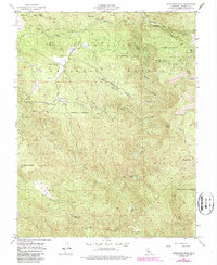
Editions of this 1947 Buckhorn Peak Map
4 editions found
Other maps of this area

1893 · Sonora
USGS Topo · 1:125,000

1896 · Sonora
USGS Topo · 1:125,000

1897 · Sonora
USGS Topo · 1:125,000

1897 · Yosemite
USGS Topo · 1:125,000

1898 · Sonora
USGS Topo · 1:125,000

1900 · Yosemite
USGS Topo · 1:125,000

1903 · Yosemite
USGS Topo · 1:125,000

1909 · Yosemite
USGS Topo · 1:125,000

1947 · San Jose
USGS Topo · 1:250,000

1947 · Mariposa
USGS Topo · 1:250,000