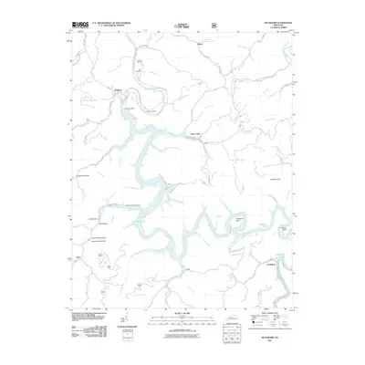
2011 Map of Buckhorn
USGS Topo · Published 2011About this map
Buckhorn Lake dominates this landscape, created by the massive Buckhorn Dam on the Middle Fork Kentucky River. This 2011 survey illustrates the dramatic transformation of the Perry County terrain where steep-walled valleys like Lonesome Hollow and Coal Hollow meet the winding reservoirs. The settlement of Buckhorn sits just north of the dam, serving as a gateway to the water, while smaller communities such as Gays Creek and Confluence are situated along the complex network of drainage forks. Genealogists will find several family-named burial sites, including Johnson Cemetery and Aims Cemetery, preserved on the slopes above the rising water. The map traces the intricate riparian network of the North Fork Kentucky River and its many tributaries, providing a clear picture of the modern recreational infrastructure at Leatherwood Boat Ramps alongside traditional mountain hollows.
Find a feature on this map
77 named features on this map. Tap any name to fly to it.
Don’t see what you’re looking for? This feature index may not catch every label — zoom into the map to look around manually.
Map Details
Editions of this 2011 Buckhorn Map
This is the sole edition of this map. No revisions or reprints were ever made.
Other maps of this area

1891 · Manchester
USGS Topo · 1:125,000

1891 · Hazard
USGS Topo · 1:125,000

1913 · Buckhorn
USGS Topo · 1:62,500

1916 · Hyden
USGS Topo · 1:48,000

1919 · Hyden
USGS Topo · 1:62,500

1953 · Buckhorn
USGS Topo · 1:24,000

1953 · Cowcreek
USGS Topo · 1:24,000

1953 · Hyden West
USGS Topo · 1:24,000

1953 · Big Creek
USGS Topo · 1:24,000

1953 · Mistletoe
USGS Topo · 1:24,000