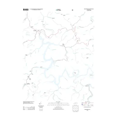
2013 Map of Buckhorn
USGS Topo · Published 2013About this map
Buckhorn Lake dominates the central landscape of this Perry County quadrangle, where the impounded waters of the Middle Fork Kentucky River create a complex shoreline of deep inlets and winding branches. The settlement of Buckhorn sits near the dam at Laurel Point, serving as a gateway to the water-based recreation at the Leatherwood Boat Ramps. The surrounding terrain is defined by a dense network of hollows and bends, including Opossum Bend and Mosley Bend, which reflect the region's intricate drainage patterns.
Find a feature on this map
94 named features on this map. Tap any name to fly to it.
Don’t see what you’re looking for? This feature index may not catch every label — zoom into the map to look around manually.
Map Details
Editions of this 2013 Buckhorn Map
This is the sole edition of this map. No revisions or reprints were ever made.
Other maps of this area

1891 · Manchester
USGS Topo · 1:125,000

1891 · Hazard
USGS Topo · 1:125,000

1913 · Buckhorn
USGS Topo · 1:62,500

1916 · Hyden
USGS Topo · 1:48,000

1919 · Hyden
USGS Topo · 1:62,500

1953 · Buckhorn
USGS Topo · 1:24,000

1953 · Cowcreek
USGS Topo · 1:24,000

1953 · Hyden West
USGS Topo · 1:24,000

1953 · Big Creek
USGS Topo · 1:24,000

1953 · Mistletoe
USGS Topo · 1:24,000