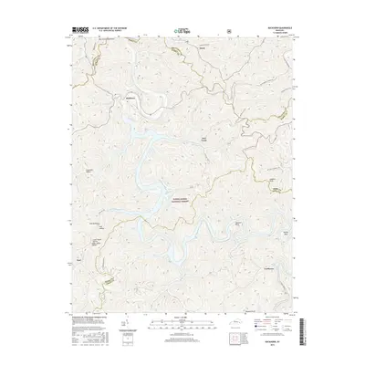
2016 Map of Buckhorn
USGS Topo · Published 2016About this map
Buckhorn lies at the heart of this landscape where the Middle Fork of the Kentucky River winds through the Daniel Boone National Forest. The settlement pattern follows the intricate branching of the waterways and hollows, with communities like Confluence and Gays Creek established at the junctions of creek beds and river bends. The intricate topography is defined by dozens of named drainages, including Lonesome Hollow, Big Groundhog Hollow, and Mill Hollow, suggesting the historic importance of local resources and timber in Perry County. Transportation through the hills is marked by routes such as State Hwy 257 and the remnants of industrial history seen at Old Railroad Rd. To the south, the terrain rises toward Langdon Knob and the river's sharp curve at Opossum Bend, illustrating the isolated, water-dependent nature of these mountain settlements.
Find a feature on this map
30 named features on this map. Tap any name to fly to it.
Don’t see what you’re looking for? This feature index may not catch every label — zoom into the map to look around manually.
Map Details
Editions of this 2016 Buckhorn Map
This is the sole edition of this map. No revisions or reprints were ever made.
Other maps of this area

1891 · Manchester
USGS Topo · 1:125,000

1891 · Hazard
USGS Topo · 1:125,000

1913 · Buckhorn
USGS Topo · 1:62,500

1916 · Hyden
USGS Topo · 1:48,000

1919 · Hyden
USGS Topo · 1:62,500

1953 · Buckhorn
USGS Topo · 1:24,000

1953 · Cowcreek
USGS Topo · 1:24,000

1953 · Hyden West
USGS Topo · 1:24,000

1953 · Big Creek
USGS Topo · 1:24,000

1953 · Mistletoe
USGS Topo · 1:24,000