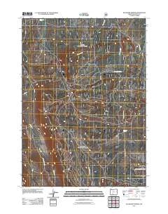
2011 Map of Buckhorn Springs
USGS Topo · Published 2011About this map
Buckhorn Springs and Corral Spring anchor this high-elevation landscape in southern Oregon, where a complex network of forest roads facilitates access through the timbered terrain. This 2011 survey illustrates the modern management of the region, emphasizing hydrological features such as Clover Creek and Meadow Creek alongside the arterial Kirk Rd. The topography is defined by the winding paths of Yoss Creek and an extensive system of development roads, including Nat For Dev Rd 4584 and Nat For Dev Rd 4582. These routes reflect the ongoing utility of the area for resource management and backcountry transit within the larger forest infrastructure of Klamath County.
Find a feature on this map
12 named features on this map. Tap any name to fly to it.
Don’t see what you’re looking for? This feature index may not catch every label — zoom into the map to look around manually.
Map Details
Editions of this 2011 Buckhorn Springs Map
This is the sole edition of this map. No revisions or reprints were ever made.
Other maps of this area

1889 · Klamath
USGS Topo · 1:250,000

1894 · Klamath
USGS Topo · 1:250,000

1955 · Klamath Falls
USGS Topo · 1:250,000

1956 · Calimus Butte
USGS Topo · 1:62,500

1957 · Klamath Marsh
USGS Topo · 1:62,500

1958 · Klamath Falls
USGS Topo · 1:250,000

1960 · Fuego Mountain
USGS Topo · 1:62,500

1960 · Yamsay Mountain
USGS Topo · 1:62,500

1980 · Williamson River
USGS Topo · 1:100,000
1988 · Applegate Butte
USGS Topo · 1:24,000