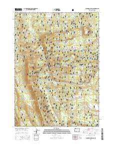
2014 Map of Buckhorn Springs
USGS Topo · Published 2014About this map
Winema National Forest encompasses this high-elevation landscape in Klamath County, characterized by a complex network of forest development roads and seasonal watercourses. The presence of Buckhorn Springs and Corral Spring highlights the importance of localized water sources in this timberland environment. The drainage patterns of the area are defined by Clover Cr, Meadow Cr, and Yoss Cr, which carve through the terrain alongside named depressions like Telephone Draw and Haystack Draw. This survey illustrates the modern management of public lands, where traditional names like Kirk Rd and Meadow Creek Rd persist alongside numbered Forest Service routes, serving as primary access points for forestry and recreation within the expansive woodland blocks of the Cascades region.
Find a feature on this map
19 named features on this map. Tap any name to fly to it.
Don’t see what you’re looking for? This feature index may not catch every label — zoom into the map to look around manually.
Map Details
Editions of this 2014 Buckhorn Springs Map
This is the sole edition of this map. No revisions or reprints were ever made.
Other maps of this area

1889 · Klamath
USGS Topo · 1:250,000

1894 · Klamath
USGS Topo · 1:250,000

1955 · Klamath Falls
USGS Topo · 1:250,000

1956 · Calimus Butte
USGS Topo · 1:62,500

1957 · Klamath Marsh
USGS Topo · 1:62,500

1958 · Klamath Falls
USGS Topo · 1:250,000

1960 · Fuego Mountain
USGS Topo · 1:62,500

1960 · Yamsay Mountain
USGS Topo · 1:62,500

1980 · Williamson River
USGS Topo · 1:100,000
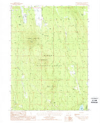
1988 · Applegate Butte
USGS Topo · 1:24,000