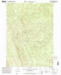
1998 Map of Buckhorn Springs
USGS Topo · Published 2000About this map
Buckhorn Springs serves as a focal point within this high-elevation landscape of the Winema National Forest, where steep drainages and isolated water sources define the terrain. The network of seasonal and perennial water, including Clover Creek and the long descent of Yoss Creek, suggests a landscape primarily utilized for timber management and backcountry navigation at the close of the 20th century. Localized features such as Telephone Spring and the curiously named Meadow provide specific landmarks for those tracing historical forest service routes or identifying remote watering holes. The presence of Haystack Draw and other unnamed draws illustrate the complex topography of the Winema National Forest before more modern digital mapping obscured some of these traditional geographic identifiers.
Find a feature on this map
8 named features on this map. Tap any name to fly to it.
Don’t see what you’re looking for? This feature index may not catch every label — zoom into the map to look around manually.
Map Details
Editions of this 1998 Buckhorn Springs Map
This is the sole edition of this map. No revisions or reprints were ever made.
Other maps of this area

1889 · Klamath
USGS Topo · 1:250,000

1894 · Klamath
USGS Topo · 1:250,000

1955 · Klamath Falls
USGS Topo · 1:250,000

1956 · Calimus Butte
USGS Topo · 1:62,500

1957 · Klamath Marsh
USGS Topo · 1:62,500

1958 · Klamath Falls
USGS Topo · 1:250,000

1960 · Fuego Mountain
USGS Topo · 1:62,500

1960 · Yamsay Mountain
USGS Topo · 1:62,500

1980 · Williamson River
USGS Topo · 1:100,000
1988 · Applegate Butte
USGS Topo · 1:24,000