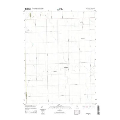
2015 Map of Buckingham
USGS Topo · Published 2015About this map
Buckingham and its surrounding agricultural landscape are defined by a network of rural roads and several small settlements in Kankakee County. This 2015 survey reveals a terrain crisscrossed by essential drainage systems, including the winding Crane Cr, Reddick Run, and Granary Cr. The map captures the quiet character of the region, where aviation and agriculture coexist at small facilities such as Hendrix Airport and Hugh van Voorst Airport. For those researching local family history, the map provides precise locations for Coleman Cem and Smith Cem, situated near established farm routes. Small communities like Reddick, Union Hill, and Cabery serve as the primary hubs for this rural area, connected by an organized grid of section-line roads such as W 1000S Rd and S 1800W Rd.
Find a feature on this map
37 named features on this map. Tap any name to fly to it.
Don’t see what you’re looking for? This feature index may not catch every label — zoom into the map to look around manually.
Map Details
Editions of this 2015 Buckingham Map
This is the sole edition of this map. No revisions or reprints were ever made.
Other maps of this area

1923 · Herscher
USGS Topo · 1:62,500

1925 · Herscher
USGS Topo · 1:62,500

1944 · Piper City
USGS Topo · 1:48,000

1947 · Piper City
USGS Topo · 1:62,500

1947 · Cullom
USGS Topo · 1:62,500

1948 · Dwight
USGS Topo · 1:62,500

1949 · Cullom
USGS Topo · 1:62,500

1950 · Dwight
USGS Topo · 1:62,500

1958 · Aurora
USGS Topo · 1:250,000

1958 · Peoria
USGS Topo · 1:250,000