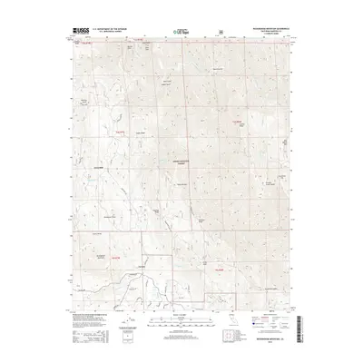
2015 Map of Buckingham Mountain
USGS Topo · Published 2015About this map
The Sierra National Forest dominates this section of the Sierra Nevada range in Mariposa County, where the terrain drops sharply toward the S Fork Merced River and Peachtree Bar. In the southwestern corner, the small communities of Jerseydale and Darrah sit along a network of mountain roads such as Jerseydale Rd and Triangle Rd. The area is marked by numerous peaks and ridges, including the prominent Buckingham Mountain and Chowchilla Mtn. Evidence of the region's mining heritage is preserved through the Apperson Mine located near Nutmeg Gulch. North of Snyder Ridge, the landscape is defined by steep drainages like Devil Gulch and Snyder Gulch, while geological features such as Casa Diablo and Sims Cove overlook the river valley, illustrating the transition from residential foothills to high-altitude wilderness.
Find a feature on this map
55 named features on this map. Tap any name to fly to it.
Don’t see what you’re looking for? This feature index may not catch every label — zoom into the map to look around manually.
Map Details
Editions of this 2015 Buckingham Mountain Map
This is the sole edition of this map. No revisions or reprints were ever made.
Other maps of this area

1897 · Yosemite
USGS Topo · 1:125,000

1900 · Yosemite
USGS Topo · 1:125,000

1903 · Yosemite
USGS Topo · 1:125,000

1909 · Yosemite
USGS Topo · 1:125,000

1912 · Mariposa
USGS Topo · 1:125,000

1947 · Mariposa
USGS Topo · 1:24,000

1947 · El Portal
USGS Topo · 1:24,000

1947 · Mariposa
USGS Topo · 1:250,000

1947 · El Portal
USGS Topo · 1:62,500

1947 · Mariposa
USGS Topo · 1:62,500