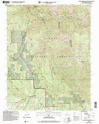
2004 Map of Buckingham Mountain
USGS Topo · Published 2007About this map
Buckingham Mountain and its namesake Buckingham Mountain Sch anchor this Mariposa County landscape during a period of forest management and historical recovery. The terrain is defined by the steep canyons of the Merced River and the South Fork Merced River, which dominate the northern half of the sheet within the Sierra National Forest. This area was historically significant for gold mining, evidenced by the presence of the Early Mine, the Comet Mine (Aband), and former locations like Hite Cove (Site) and Savage Lundy (Site).
Find a feature on this map
48 named features on this map. Tap any name to fly to it.
Don’t see what you’re looking for? This feature index may not catch every label — zoom into the map to look around manually.
Map Details
Editions of this 2004 Buckingham Mountain Map
This is the sole edition of this map. No revisions or reprints were ever made.
Other maps of this area

1897 · Yosemite
USGS Topo · 1:125,000

1900 · Yosemite
USGS Topo · 1:125,000

1903 · Yosemite
USGS Topo · 1:125,000

1909 · Yosemite
USGS Topo · 1:125,000

1912 · Mariposa
USGS Topo · 1:125,000

1947 · Mariposa
USGS Topo · 1:24,000

1947 · El Portal
USGS Topo · 1:24,000

1947 · Mariposa
USGS Topo · 1:250,000

1947 · El Portal
USGS Topo · 1:62,500

1947 · Mariposa
USGS Topo · 1:62,500