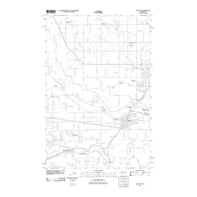
2011 Map of Buckley
USGS Topo · Published 2011About this map
Buckley and its surrounding river plains are documented here just after the turn of the 21st century, showing the established layout of this Pierce County community near the White River. The landscape is a mix of agricultural heritage and modern utility, featuring both the Muckleshoot Indian Tribe White River Hatchery and the White River Diversion Dam. South of town, the map tracks the path of South Prairie Creek through Cascade Junction and the small settlements of Burnett and Spiketon.
Find a feature on this map
80 named features on this map. Tap any name to fly to it.
Don’t see what you’re looking for? This feature index may not catch every label — zoom into the map to look around manually.
Map Details
Editions of this 2011 Buckley Map
This is the sole edition of this map. No revisions or reprints were ever made.
Other maps of this area

1897 · Tacoma
USGS Topo · 1:125,000

1900 · Tacoma
USGS Topo · 1:125,000

1913 · Cedar Lake
USGS Topo · 1:125,000

1942 · Lake Tapps
USGS Topo · 1:62,500

1944 · Lake Tapps
USGS Topo · 1:62,500

1949 · Black Diamond
USGS Topo · 1:24,000

1949 · Auburn
USGS Topo · 1:24,000

1953 · Cumberland
USGS Topo · 1:24,000

1956 · Orting
USGS Topo · 1:24,000
1956 · Sumner
USGS Topo · 1:24,000