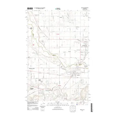
2014 Map of Buckley
USGS Topo · Published 2014About this map
The White River carves a deep valley through the center of this landscape, marking the historic boundary between King Co and Pierce Co. To the north and east, the city of Enumclaw is surrounded by a patchwork of rural holdings and significant community landmarks like the Enumclaw Municipal Cem and Holy Cross Cem. The geography is defined by broad plateaus including Muckleshoot Prairie and Connells Prairie, which supported the development of small settlements such as Wabash and Osceola.
Find a feature on this map
81 named features on this map. Tap any name to fly to it.
Don’t see what you’re looking for? This feature index may not catch every label — zoom into the map to look around manually.
Map Details
Editions of this 2014 Buckley Map
This is the sole edition of this map. No revisions or reprints were ever made.
Other maps of this area

1897 · Tacoma
USGS Topo · 1:125,000

1900 · Tacoma
USGS Topo · 1:125,000

1913 · Cedar Lake
USGS Topo · 1:125,000

1942 · Lake Tapps
USGS Topo · 1:62,500

1944 · Lake Tapps
USGS Topo · 1:62,500

1949 · Black Diamond
USGS Topo · 1:24,000

1949 · Auburn
USGS Topo · 1:24,000

1953 · Cumberland
USGS Topo · 1:24,000

1956 · Orting
USGS Topo · 1:24,000
1956 · Sumner
USGS Topo · 1:24,000