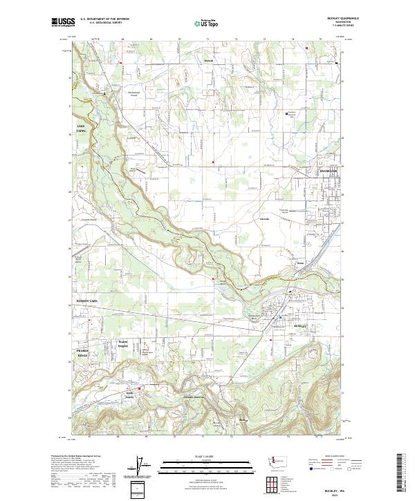
2023 Map of Buckley
USGS Topo · Published 2023About this map
The White River carves a deep valley between the industrial and residential centers of Buckley and Enumclaw, anchoring a landscape where the river’s path defines the boundary between King and Pierce Counties. This modern survey illustrates the dense network of roadways connecting established settlements like Bonney Lake and Prairie Ridge with agricultural and prairie lands to the north. Distinctive features such as Wickersham Basin and Dingle Basin highlight the unique geomorphology of the river valley, while smaller communities like Burnett and South Prairie sit along the southern riparian corridors. The persistent influence of the BNSF Railway corridor and local aviation hubs like Enumclaw Airport and Bryan Airport reflects the area's continued role as a transportation nexus for the Muckleshoot Prairie region. Genealogists will find several burial sites including Krain Cem and Buckley Cem among the residential developments.
Find a feature on this map
101 named features on this map. Tap any name to fly to it.
Don’t see what you’re looking for? This feature index may not catch every label — zoom into the map to look around manually.
Map Details
Editions of this 2023 Buckley Map
This is the sole edition of this map. No revisions or reprints were ever made.
Other maps of this area

1897 · Tacoma
USGS Topo · 1:125,000

1900 · Tacoma
USGS Topo · 1:125,000

1913 · Cedar Lake
USGS Topo · 1:125,000

1942 · Lake Tapps
USGS Topo · 1:62,500

1944 · Lake Tapps
USGS Topo · 1:62,500

1949 · Black Diamond
USGS Topo · 1:24,000

1949 · Auburn
USGS Topo · 1:24,000

1953 · Cumberland
USGS Topo · 1:24,000

1956 · Orting
USGS Topo · 1:24,000
1956 · Sumner
USGS Topo · 1:24,000