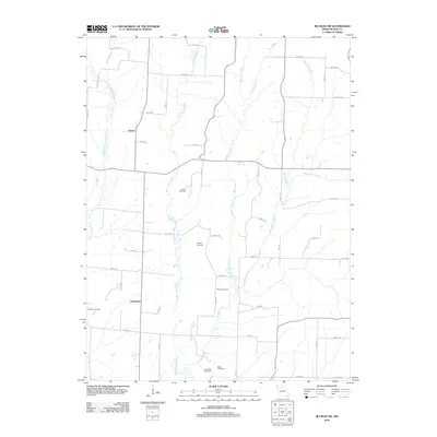
2012 Map of Bucklin NW
USGS Topo · Published 2012About this map
Johnstown and Garner appear as central points of reference in this portion of rural Linn County, where the landscape is defined by the branching tributaries of the Yellow Creek system. The topography is shaped by the parallel courses of West Yellow Creek, East Yellow Creek, and Winigan Creek, creating a series of north-south corridors that dictate the placement of local roads. The map reveals a dense network of family-named landmarks and rural infrastructure, including the Snowdon Post Office and several burial grounds that serve as vital records of early local settlement patterns. Genealogists and researchers can trace the lineage of the area through sites such as Baker Cemetery, Baugher Cemetery, Wyant Cemetery, and Pulliam Cemetery. These landmarks, alongside numerous designated routes like Laredo Dr and Kite Rd, illustrate the long-standing agricultural and social framework of this Missouri countryside.
Find a feature on this map
49 named features on this map. Tap any name to fly to it.
Don’t see what you’re looking for? This feature index may not catch every label — zoom into the map to look around manually.
Map Details
Editions of this 2012 Bucklin NW Map
This is the sole edition of this map. No revisions or reprints were ever made.
Other maps of this area

1946 · Brookfield
USGS Topo · 1:62,500

1948 · Brookfield
USGS Topo · 1:62,500

1949 · Bucklin
USGS Topo · 1:24,000

1949 · Bucklin NW
USGS Topo · 1:24,000

1950 · Bucklin
USGS Topo · 1:24,000

1950 · New Cambria West
USGS Topo · 1:24,000

1950 · Bucklin NW
USGS Topo · 1:24,000

1951 · New Boston
USGS Topo · 1:24,000

1953 · Moberly
USGS Topo · 1:250,000

1954 · Centerville
USGS Topo · 1:250,000