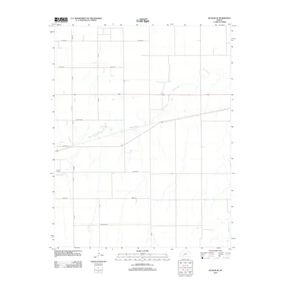
2012 Map of Bucklin SE
USGS Topo · Published 2012About this map
Rattlesnake Cr meanders across this rural section of Ford County, defining a landscape of wide drainages and established agricultural boundaries. This 2012 survey illustrates the systematic grid of the High Plains, where naming conventions for local thoroughfares like Whirlwind Rd, Windy Rd, and Wildfire Rd reflect the environmental character of the region. The map captures the intersection of traditional land use and modern infrastructure, shown through the precise alignment of 134 Rd and 135 Rd against the natural curves of the creek beds. In the southeast corner, the headwaters of Middle Kiowa Cr begin to emerge, providing a clear view of the local hydrology before it joins larger regional systems. This record is particularly useful for understanding the exact positioning of farm-to-market roads and property access points during the early 21st century.
Find a feature on this map
14 named features on this map. Tap any name to fly to it.
Don’t see what you’re looking for? This feature index may not catch every label — zoom into the map to look around manually.
Map Details
Editions of this 2012 Bucklin SE Map
This is the sole edition of this map. No revisions or reprints were ever made.
Other maps of this area

1889 · Kinsley
USGS Topo · 1:125,000

1892 · Kinsley
USGS Topo · 1:125,000

1892 · Spearville
USGS Topo · 1:125,000

1892 · Coldwater
USGS Topo · 1:125,000

1894 · Spearville
USGS Topo · 1:125,000

1894 · Kinsley
USGS Topo · 1:125,000

1896 · Ashland
USGS Topo · 1:125,000

1955 · Pratt
USGS Topo · 1:250,000

1959 · Pratt
USGS Topo · 1:250,000

1969 · Bucklin NE
USGS Topo · 1:24,000