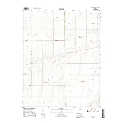
2015 Map of Bucklin SE
USGS Topo · Published 2015About this map
The agrarian plains of southwest Kansas define this region at the border of Ford and Kiowa Counties. This 2015 survey centers on the southeastern outskirts of Bucklin, where the landscape is organized by an extensive grid of section-line roads with evocative names like Whirlwind Rd, Windy Rd, and Wildfire Rd. The geography is dictated by the subtle drainage of the High Plains, most notably where Rattlesnake Creek meanders through the central portions of the map before the terrain shifts toward Middle Kiowa Cr in the southeast. These watercourses provide the only significant breaks in the uniform agricultural patterns. The survey documents a modern rural infrastructure, showing the persistence of traditional land divisions such as t28s r21w and t29s r20w alongside contemporary transportation routes like Warrior Rd and Upland Rd.
Find a feature on this map
21 named features on this map. Tap any name to fly to it.
Don’t see what you’re looking for? This feature index may not catch every label — zoom into the map to look around manually.
Map Details
Editions of this 2015 Bucklin SE Map
This is the sole edition of this map. No revisions or reprints were ever made.
Other maps of this area

1889 · Kinsley
USGS Topo · 1:125,000

1892 · Kinsley
USGS Topo · 1:125,000

1892 · Spearville
USGS Topo · 1:125,000

1892 · Coldwater
USGS Topo · 1:125,000

1894 · Spearville
USGS Topo · 1:125,000

1894 · Kinsley
USGS Topo · 1:125,000

1896 · Ashland
USGS Topo · 1:125,000

1955 · Pratt
USGS Topo · 1:250,000

1959 · Pratt
USGS Topo · 1:250,000

1969 · Bucklin NE
USGS Topo · 1:24,000