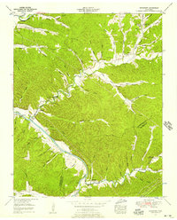
1952 Map of Bucksnort
USGS Topo · Published 1957About this map
The Duck River winds through the hills of Humphreys and Hickman counties, carving a deep valley defined by numerous tributary hollows and spring-fed branches. This mid-century landscape is marked by small settlements like Taylortown and Bucksnort, where local life centered around rural institutions and family landholdings. A gaging station at Mile 26 and a Sand Quarry near the river bank point to the area's geological and hydrological significance during this era of Tennessee Valley development.
Find a feature on this map
70 named features on this map. Tap any name to fly to it.
Don’t see what you’re looking for? This feature index may not catch every label — zoom into the map to look around manually.
Map Details
Editions of this 1952 Bucksnort Map
2 editions found
Other maps of this area

1936 · Gorman
USGS Topo · 1:24,000

1936 · Hurricane Mills
USGS Topo · 1:24,000

1936 · Coble
USGS Topo · 1:24,000

1936 · Whitfield
USGS Topo · 1:24,000

1936 · Bucksnort
USGS Topo · 1:24,000

1936 · Spot
USGS Topo · 1:24,000

1936 · Lobelville
USGS Topo · 1:24,000

1936 · Waverly
USGS Topo · 1:24,000

1936 · Tennessee City
USGS Topo · 1:24,000
1950 · Hurricane Mills
USGS Topo · 1:24,000