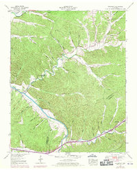
1952 Map of Bucksnort
USGS Topo · Published 1970About this map
Bucksnort and the surrounding river bottomlands sit along the winding course of the Duck River at the border of Humphreys and Hickman counties. This 1952 survey, updated with 1968 aerial revisions, shows a rural landscape defined by narrow hollows and numerous family-named landmarks. The terrain is deeply dissected by drainages such as Tumbling Creek, Sugar Creek, and Hurricane Creek, with the river marked by navigational waypoints like Mile 26 and the Gaging station.
Find a feature on this map
80 named features on this map. Tap any name to fly to it.
Don’t see what you’re looking for? This feature index may not catch every label — zoom into the map to look around manually.
Map Details
Editions of this 1952 Bucksnort Map
2 editions found
Other maps of this area

1936 · Gorman
USGS Topo · 1:24,000

1936 · Hurricane Mills
USGS Topo · 1:24,000

1936 · Coble
USGS Topo · 1:24,000

1936 · Whitfield
USGS Topo · 1:24,000

1936 · Bucksnort
USGS Topo · 1:24,000

1936 · Spot
USGS Topo · 1:24,000

1936 · Lobelville
USGS Topo · 1:24,000

1936 · Waverly
USGS Topo · 1:24,000

1936 · Tennessee City
USGS Topo · 1:24,000
1950 · Hurricane Mills
USGS Topo · 1:24,000