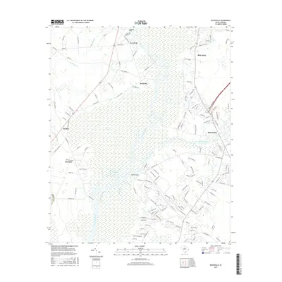
2017 Map of Bucksville
USGS Topo · Published 2017About this map
The Waccamaw River winds through a vast network of wetlands and low-lying plains in this 2017 study of coastal South Carolina. The settlement of Bucksville stands as a focal point, supported by the nearby Buck Graveyard and names that hint at the region's agricultural and timber heritage, such as Oatbed Island and Ransoms Bluff. The landscape is defined by the meeting of natural swamp systems like Cowford Swamp and Big Swamp with engineered waterways, most notably the Intracoastal Waterway which cuts through the eastern portion near Socastee. To the west, the community of Bucksport and the landing at Klondike provide access to the complex river channels of Bull Creek and Old River, where the terrain transitions into the labyrinthine Seven Prongs. This map documents a contemporary view of these established communities as they relate to the enduring hydrology of the Grand Strand's inland river systems.
Find a feature on this map
145 named features on this map. Tap any name to fly to it.
Don’t see what you’re looking for? This feature index may not catch every label — zoom into the map to look around manually.
Map Details
Editions of this 2017 Bucksville Map
This is the sole edition of this map. No revisions or reprints were ever made.
Other maps of this area

1937 · Myrtle Beach
USGS Topo · 1:48,000

1937 · Nixonville
USGS Topo · 1:48,000

1940 · Myrtle Beach
USGS Topo · 1:62,500

1942 · Nixonville
USGS Topo · 1:62,500

1943 · Yauhannah
USGS Topo · 1:24,000

1943 · Bucksville
USGS Topo · 1:24,000

1943 · Brookgreen
USGS Topo · 1:24,000

1943 · Plantersville
USGS Topo · 1:24,000

1943 · Dongola
USGS Topo · 1:24,000

1943 · Conway
USGS Topo · 1:24,000