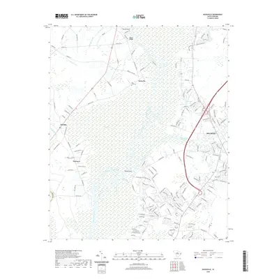
2020 Map of Bucksville
USGS Topo · Published 2020About this map
The Waccamaw River carves a winding path through this corner of Horry County, defining a landscape of expansive wetlands and historic riverside settlements. Bucksville and Bucksport serve as focal points along the river's edge, reflecting a long-standing relationship with the water. The intricate drainage network is visible through features like Old River Seven Prongs and Peach Creek, which wrap around Oatbed Island. To the east, the modern influence of the Intracoastal Waterway is evident as it cuts through the terrain near Socastee, contrasting with the more organic flow of the river. Genealogists can identify localized landmarks such as the Buck Graveyard and smaller communities like Klondike and Ransoms Bluff. The map illustrates a region where dense swamp systems like Big Swamp and Halfway Swamp hem in residential development, dictating the placement of roads and homesteads.
Find a feature on this map
159 named features on this map. Tap any name to fly to it.
Don’t see what you’re looking for? This feature index may not catch every label — zoom into the map to look around manually.
Map Details
Editions of this 2020 Bucksville Map
This is the sole edition of this map. No revisions or reprints were ever made.
Other maps of this area

1937 · Myrtle Beach
USGS Topo · 1:48,000

1937 · Nixonville
USGS Topo · 1:48,000

1940 · Myrtle Beach
USGS Topo · 1:62,500

1942 · Nixonville
USGS Topo · 1:62,500

1943 · Yauhannah
USGS Topo · 1:24,000

1943 · Bucksville
USGS Topo · 1:24,000

1943 · Brookgreen
USGS Topo · 1:24,000

1943 · Plantersville
USGS Topo · 1:24,000

1943 · Dongola
USGS Topo · 1:24,000

1943 · Conway
USGS Topo · 1:24,000