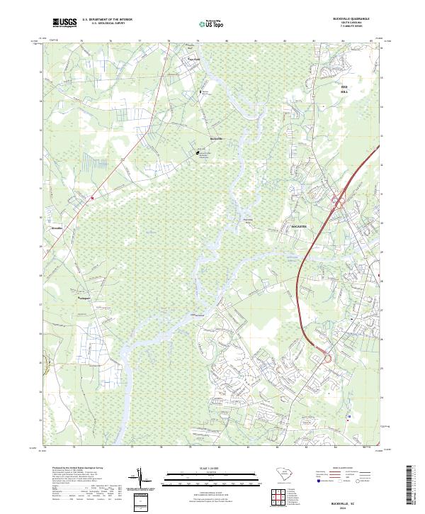
2024 Map of Bucksville
USGS Topo · Published 2024About this map
Waccamaw National Wildlife Refuge dominates this modern topographical survey of coastal South Carolina, where the winding Waccamaw River meets a complex network of wetlands and tidal creeks. The settlement of Bucksville serves as a focal point for local genealogy, preserving the Buck Cemetery and Hebron United Methodist Church Cemetery. These sites, along with Marlow Branch Cemetery, offer critical points of reference for tracing family history in Horry County. The landscape is defined by the transition from the river’s natural course, including features like Oatbed Island and Ransoms Bluff, to the engineered Intracoastal Waterway passing near Socastee. Historical river crossings are still noted at Peachtree Ferry, while inland, the proximity of Bucksport and Klondike reflects the persistent layout of these rural communities amidst the expansive Big Swamp and Cowford Swamp lowlands.
Find a feature on this map
175 named features on this map. Tap any name to fly to it.
Don’t see what you’re looking for? This feature index may not catch every label — zoom into the map to look around manually.
Map Details
Editions of this 2024 Bucksville Map
This is the sole edition of this map. No revisions or reprints were ever made.
Other maps of this area

1937 · Myrtle Beach
USGS Topo · 1:48,000

1937 · Nixonville
USGS Topo · 1:48,000

1940 · Myrtle Beach
USGS Topo · 1:62,500

1942 · Nixonville
USGS Topo · 1:62,500

1943 · Yauhannah
USGS Topo · 1:24,000

1943 · Bucksville
USGS Topo · 1:24,000

1943 · Brookgreen
USGS Topo · 1:24,000

1943 · Plantersville
USGS Topo · 1:24,000

1943 · Dongola
USGS Topo · 1:24,000

1943 · Conway
USGS Topo · 1:24,000