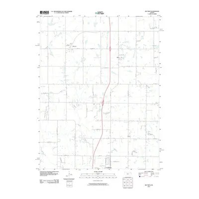
2010 Map of Bucyrus
USGS Topo · Published 2010About this map
Bucyrus and the surrounding Miami County landscape are defined by a grid of rural roads and the meandering courses of local waterways. This 2010 survey shows the village of Bucyrus concentrated near the Bucyrus Post Office and along Main St, while the small community of Wea sits to the east near the Wea Cemetery. The drainage patterns of Tenmile Creek and North Wea Creek influence the local topography, which is predominantly agricultural with scattered homesteads. To the south, the northern portion of Louisburg appears as it begins to transition from a rural town into more developed residential areas. For researchers, the map provides a clear look at the spatial relationship between these small Kansas settlements and their local burial grounds, including Cross Cemetery located near Rockville Rd.
Find a feature on this map
52 named features on this map. Tap any name to fly to it.
Don’t see what you’re looking for? This feature index may not catch every label — zoom into the map to look around manually.
Map Details
Editions of this 2010 Bucyrus Map
This is the sole edition of this map. No revisions or reprints were ever made.
Other maps of this area

1887 · Olathe
USGS Topo · 1:125,000

1893 · Olathe
USGS Topo · 1:125,000

1947 · Lawrence
USGS Topo · 1:250,000

1950 · Lawrence
USGS Topo · 1:250,000
1953 · Belton
USGS Topo · 1:24,000

1953 · Freeman
USGS Topo · 1:24,000

1953 · West Line
USGS Topo · 1:24,000

1956 · Stilwell
USGS Topo · 1:24,000

1956 · Bucyrus
USGS Topo · 1:24,000
1956 · Ocheltree
USGS Topo · 1:24,000