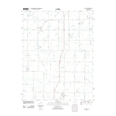
2012 Map of Bucyrus
USGS Topo · Published 2012About this map
The unincorporated community of Bucyrus sits at the junction of Quivira Rd and W 223rd St in northern Miami County, where the grid of rural section roads begins to meet the expanding suburban reach of the Kansas City metropolitan area. The landscape is defined by the winding drainages of Ten Mile Cr and N Wea Cr, which break up the otherwise uniform agricultural parcels.
Find a feature on this map
59 named features on this map. Tap any name to fly to it.
Don’t see what you’re looking for? This feature index may not catch every label — zoom into the map to look around manually.
Map Details
Editions of this 2012 Bucyrus Map
This is the sole edition of this map. No revisions or reprints were ever made.
Other maps of this area

1887 · Olathe
USGS Topo · 1:125,000

1893 · Olathe
USGS Topo · 1:125,000

1947 · Lawrence
USGS Topo · 1:250,000

1950 · Lawrence
USGS Topo · 1:250,000
1953 · Belton
USGS Topo · 1:24,000

1953 · Freeman
USGS Topo · 1:24,000

1953 · West Line
USGS Topo · 1:24,000

1956 · Stilwell
USGS Topo · 1:24,000

1956 · Bucyrus
USGS Topo · 1:24,000
1956 · Ocheltree
USGS Topo · 1:24,000