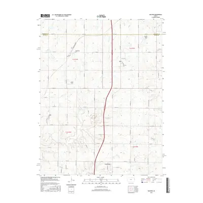
2015 Map of Bucyrus
USGS Topo · Published 2015About this map
The boundary between Johnson Co and Miami Co bisects this Kansas landscape, where the northern outskirts of Louisburg meet a patchwork of rural homesteads and agricultural tracts. Transport and small-scale aviation define the region, with the corridors of Metcalf Rd and the Railroad Frontage Rd connecting established centers. The map documents several small community hubs such as Bucyrus and Wea, each anchored by local landmarks like the Bucyrus Cem and the Wea Community Cem.
Find a feature on this map
58 named features on this map. Tap any name to fly to it.
Don’t see what you’re looking for? This feature index may not catch every label — zoom into the map to look around manually.
Map Details
Editions of this 2015 Bucyrus Map
This is the sole edition of this map. No revisions or reprints were ever made.
Other maps of this area

1887 · Olathe
USGS Topo · 1:125,000

1893 · Olathe
USGS Topo · 1:125,000

1947 · Lawrence
USGS Topo · 1:250,000

1950 · Lawrence
USGS Topo · 1:250,000
1953 · Belton
USGS Topo · 1:24,000

1953 · Freeman
USGS Topo · 1:24,000

1953 · West Line
USGS Topo · 1:24,000

1956 · Stilwell
USGS Topo · 1:24,000

1956 · Bucyrus
USGS Topo · 1:24,000
1956 · Ocheltree
USGS Topo · 1:24,000