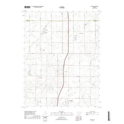
2018 Map of Bucyrus
USGS Topo · Published 2018About this map
The borderlands of Johnson and Miami Counties are defined here by a mix of agricultural tradition and modern infrastructure. The small unincorporated community of Bucyrus and the settlement of Wea anchor the northern half of the region, while the northern edge of Louisburg begins to appear at the southern margin. Local history is preserved at the Bucyrus Cem and the Wea Community Cem, reflecting the area's deep-rooted rural character.
Find a feature on this map
65 named features on this map. Tap any name to fly to it.
Don’t see what you’re looking for? This feature index may not catch every label — zoom into the map to look around manually.
Map Details
Editions of this 2018 Bucyrus Map
This is the sole edition of this map. No revisions or reprints were ever made.
Other maps of this area

1887 · Olathe
USGS Topo · 1:125,000

1893 · Olathe
USGS Topo · 1:125,000

1947 · Lawrence
USGS Topo · 1:250,000

1950 · Lawrence
USGS Topo · 1:250,000
1953 · Belton
USGS Topo · 1:24,000

1953 · Freeman
USGS Topo · 1:24,000

1953 · West Line
USGS Topo · 1:24,000

1956 · Stilwell
USGS Topo · 1:24,000

1956 · Bucyrus
USGS Topo · 1:24,000
1956 · Ocheltree
USGS Topo · 1:24,000