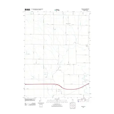
2012 Map of Buda NE
USGS Topo · Published 2012About this map
Big Bureau Creek and its many tributaries, including West Bureau Creek and Maple Grove Creek, define the drainage patterns across this Bureau County landscape. The area is characterized by a dense grid of rural roads and county highways such as Wyanet Walnut Road and Backbone Road, which serve the agricultural heartland of Illinois. This 2012 survey provides a valuable resource for genealogists, as it identifies numerous family burial grounds and small cemeteries scattered throughout the countryside.
Find a feature on this map
56 named features on this map. Tap any name to fly to it.
Don’t see what you’re looking for? This feature index may not catch every label — zoom into the map to look around manually.
Map Details
Editions of this 2012 Buda NE Map
This is the sole edition of this map. No revisions or reprints were ever made.
Other maps of this area

1893 · Hennepin
USGS Topo · 1:62,500

1909 · Hennepin
USGS Topo · 1:62,500

1911 · Hennepin
USGS Topo · 1:62,500

1921 · Buda
USGS Topo · 1:62,500

1923 · Buda
USGS Topo · 1:62,500

1949 · Walnut
USGS Topo · 1:62,500

1951 · Amboy
USGS Topo · 1:62,500

1958 · Aurora
USGS Topo · 1:250,000

1961 · Aurora
USGS Topo · 1:250,000
1966 · Princeton North
USGS Topo · 1:24,000