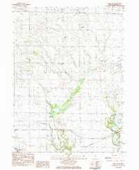
1983 Map of Buda NE
USGS Topo · Published 1984About this map
Big Bureau Creek and its tributaries define the landscape of this Bureau County quadrangle, carving through the rural terrain of Walnut and Bureau townships. The map documents a deeply rooted agricultural community, centered on landmarks like the Bureau Township Sch and the Community Ch. Family-named sites such as Roggy Cem, Sapp Cem, and Aldrich Cem are scattered across the township, providing essential points of reference for genealogists and local historians tracking the area's early residents.
Find a feature on this map
19 named features on this map. Tap any name to fly to it.
Don’t see what you’re looking for? This feature index may not catch every label — zoom into the map to look around manually.
Map Details
Editions of this 1983 Buda NE Map
This is the sole edition of this map. No revisions or reprints were ever made.
Other maps of this area

1893 · Hennepin
USGS Topo · 1:62,500

1909 · Hennepin
USGS Topo · 1:62,500

1911 · Hennepin
USGS Topo · 1:62,500

1921 · Buda
USGS Topo · 1:62,500

1923 · Buda
USGS Topo · 1:62,500

1949 · Walnut
USGS Topo · 1:62,500

1951 · Amboy
USGS Topo · 1:62,500

1958 · Aurora
USGS Topo · 1:250,000

1961 · Aurora
USGS Topo · 1:250,000
1966 · Princeton North
USGS Topo · 1:24,000