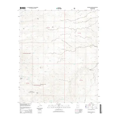
2014 Map of Buehman Canyon
USGS Topo · Published 2014About this map
The Santa Catalina Mountains dominate this high-desert landscape, where deep drainages like Buehman Canyon and Diablo Canyon carve through the foothills of the Coronado National Forest. This terrain is defined by its complex hydrology, with numerous named springs and tanks such as Peck Spring, Cottonwood Cove Spring, and Lonehill Tank serving as vital water points for cattle and wildlife in an otherwise arid environment. The map shows the transition from the steep peaks down to Davis Mesa and the broader drainage systems of Alder Wash and Geesaman Wash. Development is sparse, concentrated primarily along N Redington Rd on the eastern edge, while the interior remains a remote network of canyons like Edgar Canyon and Peck Canyon that reflect the traditional ranching and public land use patterns of Pima County.
Find a feature on this map
35 named features on this map. Tap any name to fly to it.
Don’t see what you’re looking for? This feature index may not catch every label — zoom into the map to look around manually.
Map Details
Editions of this 2014 Buehman Canyon Map
This is the sole edition of this map. No revisions or reprints were ever made.
Other maps of this area

1904 · Tucson
USGS Topo · 1:125,000

1905 · Tucson
USGS Topo · 1:125,000

1911 · Winkelman
USGS Topo · 1:125,000

1913 · Winkelman
USGS Topo · 1:125,000

1938 · Galiuro Mts
USGS Topo · 1:48,000

1943 · Galiuro Mts
USGS Topo · 1:62,500

1945 · Redington
USGS Topo · 1:62,500

1948 · Mammoth
USGS Topo · 1:62,500

1948 · Campo Bonito
USGS Topo · 1:24,000

1948 · Peppersauce Wash
USGS Topo · 1:24,000