
1948 Map of Peppersauce Wash
USGS Topo · Published 1965About this map
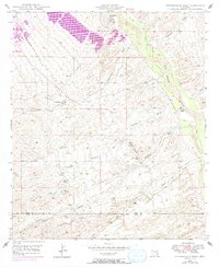
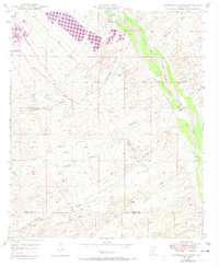
The San Pedro River corridor defines this arid landscape along the border of Pinal and Pima counties. This post-war survey illustrates a high-desert environment where water management was critical for survival and industry, evidenced by the scattered distribution of tanks, a Windmill, and a notable Artesian Well (Hot) near the northern boundary. The terrain is dominated by a complex network of ephemeral drainage systems including Peppersauce Wash, Catalina Wash, and Alder Wash, all of which feed into the primary river valley to the east.
Find a feature on this map
17 named features on this map. Tap any name to fly to it.
Don’t see what you’re looking for? This feature index may not catch every label — zoom into the map to look around manually.
Map Details
Editions of this 1948 Peppersauce Wash Map
3 editions found
Other maps of this area

1904 · Tucson
USGS Topo · 1:125,000

1905 · Tucson
USGS Topo · 1:125,000

1911 · Winkelman
USGS Topo · 1:125,000

1913 · Winkelman
USGS Topo · 1:125,000

1938 · Galiuro Mts
USGS Topo · 1:48,000

1943 · Galiuro Mts
USGS Topo · 1:62,500

1945 · Redington
USGS Topo · 1:62,500

1948 · Clark Ranch
USGS Topo · 1:24,000

1948 · Mammoth
USGS Topo · 1:62,500

1948 · Mammoth
USGS Topo · 1:24,000