
1948 Map of Clark Ranch
USGS Topo · Published 1958About this map
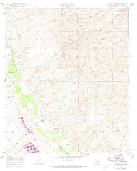
Clark Ranch and its neighboring Clark School anchor this 1940s landscape, situated along the eastern bank of the San Pedro River. The terrain is defined by a dense network of desert washes, including Mulberry Wash, Cottonwood Wash, and Clark Wash, which drain the elevated ground surrounding Bunker Hill. This survey reveals a reliance on groundwater in the arid Pinal County interior, evidenced by numerous windmills and specifically labeled water sources like an Artesian Well (Hot) and an Artesian Well (Warm). Evidence of early industrial activity is found near the river at a noted Smelter. The convergence of these natural drainage systems into the San Pedro valley highlights the historical importance of the river corridor for ranching and settlement in this portion of the Arizona desert.
Find a feature on this map
28 named features on this map. Tap any name to fly to it.
Don’t see what you’re looking for? This feature index may not catch every label — zoom into the map to look around manually.
Map Details
Editions of this 1948 Clark Ranch Map
2 editions found
Other maps of this area

1911 · Winkelman
USGS Topo · 1:125,000

1913 · Winkelman
USGS Topo · 1:125,000

1938 · Galiuro Mts
USGS Topo · 1:48,000

1938 · Klondyke
USGS Topo · 1:48,000

1943 · Galiuro Mts
USGS Topo · 1:62,500

1943 · Klondyke
USGS Topo · 1:62,500

1948 · Mammoth
USGS Topo · 1:62,500

1948 · Mammoth
USGS Topo · 1:24,000

1948 · Campo Bonito
USGS Topo · 1:24,000

1948 · Peppersauce Wash
USGS Topo · 1:24,000