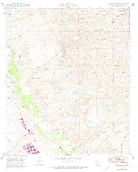
1948 Map of Clark Ranch
USGS Topo · Published 1974About this map
Clark Ranch and the nearby Clark School anchor this 1948 survey of the lower San Pedro River valley, showing a landscape defined by ranching and the water sources that sustain it. The area is marked by a complex network of ephemeral drainage channels including Mulberry Wash, Clark Wash, and James Wash, all feeding into the river. This specific era of mapping records both the traditional agricultural life and the encroaching industrial and recreational footprints, evidenced by the Smelter and a designated Trailer Park.
Find a feature on this map
22 named features on this map. Tap any name to fly to it.
Don’t see what you’re looking for? This feature index may not catch every label — zoom into the map to look around manually.
Map Details
Editions of this 1948 Clark Ranch Map
2 editions found
Other maps of this area

1911 · Winkelman
USGS Topo · 1:125,000

1913 · Winkelman
USGS Topo · 1:125,000

1938 · Galiuro Mts
USGS Topo · 1:48,000

1938 · Klondyke
USGS Topo · 1:48,000

1943 · Galiuro Mts
USGS Topo · 1:62,500

1943 · Klondyke
USGS Topo · 1:62,500

1948 · Clark Ranch
USGS Topo · 1:24,000

1948 · Mammoth
USGS Topo · 1:62,500

1948 · Mammoth
USGS Topo · 1:24,000

1948 · Campo Bonito
USGS Topo · 1:24,000