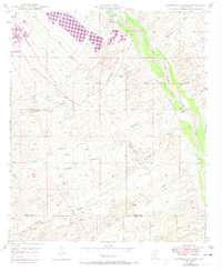
1948 Map of Peppersauce Wash
USGS Topo · Published 1974About this map
San Manuel and the surrounding desert landscape are captured here during a period of industrial transition, based on data from the late 1940s with early 1970s revisions. The area is defined by the broad valley of the San Pedro River, where the Sacaton Ranch sits near the riparian corridor. The arrival of the San Manuel Arizona RR and the development of the townsite itself signify the mid-century copper mining boom that reshaped this portion of the San Pedro Valley.
Find a feature on this map
18 named features on this map. Tap any name to fly to it.
Don’t see what you’re looking for? This feature index may not catch every label — zoom into the map to look around manually.
Map Details
Editions of this 1948 Peppersauce Wash Map
3 editions found

Other maps of this area

1904 · Tucson
USGS Topo · 1:125,000

1905 · Tucson
USGS Topo · 1:125,000

1911 · Winkelman
USGS Topo · 1:125,000

1913 · Winkelman
USGS Topo · 1:125,000

1938 · Galiuro Mts
USGS Topo · 1:48,000

1943 · Galiuro Mts
USGS Topo · 1:62,500

1945 · Redington
USGS Topo · 1:62,500

1948 · Clark Ranch
USGS Topo · 1:24,000

1948 · Mammoth
USGS Topo · 1:62,500

1948 · Mammoth
USGS Topo · 1:24,000