
1955 Map of Buena Vista NE
USGS Topo · Published 1959About this map
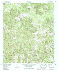
Pine Knot Creek and its many tributaries carve a network of ridges across this mid-century landscape in Marion County. The rural character of the era is defined by a high density of country churches and small cemeteries, which served as the primary social and spiritual hubs for the dispersed farming population. Points of interest like New Home Ch and Bethany Ch are connected by a web of unimproved dirt roads, indicating a localized economy still deeply tied to the land. The presence of the Rowland Tower suggests the importance of fire observation or telecommunications in this heavily wooded area. To the south, Heards Lakes and various crossings such as the Ford on Hardage Creek highlight how local travel was still dictated by natural watercourses before modern bridge infrastructure became ubiquitous.
Find a feature on this map
18 named features on this map. Tap any name to fly to it.
Don’t see what you’re looking for? This feature index may not catch every label — zoom into the map to look around manually.
Map Details
Editions of this 1955 Buena Vista NE Map
2 editions found
Other maps of this area

1907 · Talbotton
USGS Topo · 1:125,000

1949 · Glen Alta
USGS Topo · 1:24,000

1949 · Upatoi
USGS Topo · 1:24,000

1949 · Buena Vista NW
USGS Topo · 1:24,000

1950 · Geneva
USGS Topo · 1:24,000

1950 · Buena Vista NE
USGS Topo · 1:24,000

1950 · Buena Vista
USGS Topo · 1:24,000

1950 · Buena Vista
USGS Topo · 1:62,500

1950 · Talbotton
USGS Topo · 1:62,500
1955 · Buena Vista NW
USGS Topo · 1:24,000