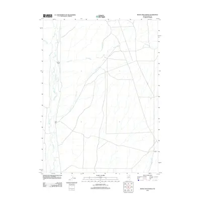
2012 Map of Buena Vista Ranch
USGS Topo · Published 2012About this map
Marys River winds through this high-desert basin of Elko County, defining a landscape of riparian corridors and sprawling ranchlands. The area's water network is primary, with Hanks Creek, Spring Creek, and Stormy Creek carving paths through the terrain to join the main river. These water sources have historically dictated the placement of remote outposts such as Buena Vista Ranch, located near the river's bend, and Grock Ranch to the southeast. The geography is marked by distinct features like Spring Gulch and the seasonal flows of Tabor Creek. Access to this isolated section of Nevada is provided by long rural stretches like the Deeth-Oneal Rd, which connects the various ranching operations that characterize the local economy and land use in this part of the Great Basin.
Find a feature on this map
10 named features on this map. Tap any name to fly to it.
Don’t see what you’re looking for? This feature index may not catch every label — zoom into the map to look around manually.
Map Details
Editions of this 2012 Buena Vista Ranch Map
This is the sole edition of this map. No revisions or reprints were ever made.
Other maps of this area

1955 · Wells
USGS Topo · 1:250,000

1958 · Wells
USGS Topo · 1:250,000

1961 · Wells
USGS Topo · 1:250,000

1967 · Black Butte SW
USGS Topo · 1:24,000

1967 · Black Butte
USGS Topo · 1:24,000

1967 · Hot Springs Creek
USGS Topo · 1:24,000

1967 · Buena Vista Ranch
USGS Topo · 1:24,000

1967 · Black Butte NE
USGS Topo · 1:24,000

1967 · Hanks Creek NE
USGS Topo · 1:24,000

1968 · Marys River Basin SE
USGS Topo · 1:24,000