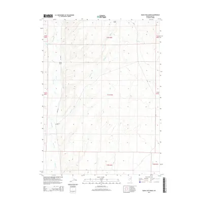
2014 Map of Buena Vista Ranch
USGS Topo · Published 2014About this map
Buena Vista Ranch stands as a primary landmark in this high-desert landscape of northern Elko County, situated along the western edge of the quadrangle. The terrain is defined by a sophisticated network of drainage systems feeding into the Marys River, which meanders through the western half of the territory. Notable tributaries such as Stormy Cr, Currant Crk, and Tabor Cr carve through the basin, illustrating the complex hydrology of the region. The map captures a moment in the early 21st century when human footprint remains light, centered around the ranch and the small settlement at Spring Gulch. Secondary transport is facilitated by local routes like CR-753, while the Public Land Survey System grid provides the organizational framework for this cattle-ranching and watershed country.
Find a feature on this map
18 named features on this map. Tap any name to fly to it.
Don’t see what you’re looking for? This feature index may not catch every label — zoom into the map to look around manually.
Map Details
Editions of this 2014 Buena Vista Ranch Map
This is the sole edition of this map. No revisions or reprints were ever made.
Other maps of this area

1955 · Wells
USGS Topo · 1:250,000

1958 · Wells
USGS Topo · 1:250,000

1961 · Wells
USGS Topo · 1:250,000

1967 · Black Butte SW
USGS Topo · 1:24,000

1967 · Black Butte
USGS Topo · 1:24,000

1967 · Hot Springs Creek
USGS Topo · 1:24,000

1967 · Buena Vista Ranch
USGS Topo · 1:24,000

1967 · Black Butte NE
USGS Topo · 1:24,000

1967 · Hanks Creek NE
USGS Topo · 1:24,000

1968 · Marys River Basin SE
USGS Topo · 1:24,000