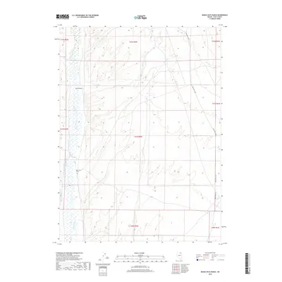
2018 Map of Buena Vista Ranch
USGS Topo · Published 2018About this map
Buena Vista Ranch sits along the western edge of this High Desert landscape, where the Marys River flows southward through Elko County. The terrain is defined by a series of intermittent drainage systems, including Spring Cr, Stormy Cr, and Hanks Cr, which carve through the high elevations of the Great Basin. This 2018 survey illustrates the sparse, ranch-oriented settlement patterns characteristic of northeastern Nevada, where geography is dictated by water access and narrow valley corridors like Spring Gulch. Connectivity in this remote quadrant is maintained by rural thoroughfares such as the O'Neil-Deeth Co Rd, which skirts the eastern foothills near where Tabor Cr enters the frame. The map provides a precise look at section lines and township boundaries that govern these wide-open cattle-grazing lands.
Find a feature on this map
17 named features on this map. Tap any name to fly to it.
Don’t see what you’re looking for? This feature index may not catch every label — zoom into the map to look around manually.
Map Details
Editions of this 2018 Buena Vista Ranch Map
This is the sole edition of this map. No revisions or reprints were ever made.
Other maps of this area

1955 · Wells
USGS Topo · 1:250,000

1958 · Wells
USGS Topo · 1:250,000

1961 · Wells
USGS Topo · 1:250,000

1967 · Black Butte SW
USGS Topo · 1:24,000

1967 · Black Butte
USGS Topo · 1:24,000

1967 · Hot Springs Creek
USGS Topo · 1:24,000

1967 · Buena Vista Ranch
USGS Topo · 1:24,000

1967 · Black Butte NE
USGS Topo · 1:24,000

1967 · Hanks Creek NE
USGS Topo · 1:24,000

1968 · Marys River Basin SE
USGS Topo · 1:24,000