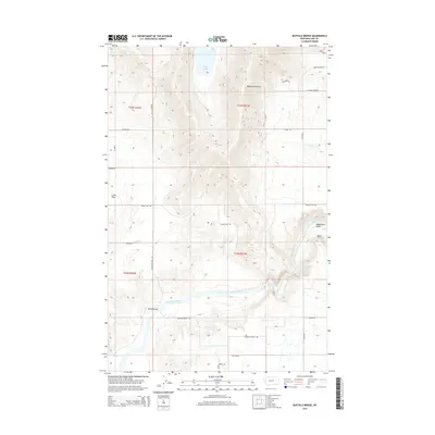
2014 Map of Buffalo Bridge
USGS Topo · Published 2014About this map
The Flathead River carves a significant course through this portion of Lake County, Montana, providing a focal point for the surrounding topography of Irvine Flats and the steep drainage of Weythman Gulch. The landscape is defined by the sharp transition from the river valley up to the northern heights near Loon Lake. Local movement is tied to the eponymous Buffalo Bridge, which serves as a vital crossing point for a network of rural routes, including Buffalo Bridge Rd and Irvine Flats Rd. Farther south, the terrain descends toward White Earth Cr via Eli Gap Rd and River Breaks Rd, reflecting a land use dominated by ranching and rural access. The grid of the Public Land Survey System, specifically T22N R21W and T23N R21W, provides the underlying structure for the scattered homesteads and property lines that mark this Western Montana corridor.
Find a feature on this map
25 named features on this map. Tap any name to fly to it.
Don’t see what you’re looking for? This feature index may not catch every label — zoom into the map to look around manually.
Map Details
Editions of this 2014 Buffalo Bridge Map
This is the sole edition of this map. No revisions or reprints were ever made.
Other maps of this area

1920 · Flathead Lake
USGS Topo · 1:125,000

1956 · Wallace
USGS Topo · 1:250,000

1960 · Wallace
USGS Topo · 1:250,000

1964 · Buffalo Bridge
USGS Topo · 1:24,000

1964 · Wild Horse Island
USGS Topo · 1:24,000

1964 · Irvine Lookout Tower
USGS Topo · 1:24,000

1964 · Elmo
USGS Topo · 1:24,000

1964 · Polson
USGS Topo · 1:24,000

1964 · Lower Crow Reservoir
USGS Topo · 1:24,000

1965 · Oliver Point
USGS Topo · 1:24,000