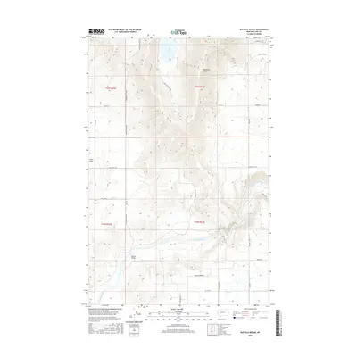
2017 Map of Buffalo Bridge
USGS Topo · Published 2017About this map
The Flathead River cuts a deep, winding course through the southwestern portion of this Lake County terrain, anchoring the settlement of Buffalo Bridge. To the north, the landscape transitions into the high, open expanse of Irvine Flats, a region marked by long, straight rural routes such as Irvine Flats Rd and Pickett Rd. The topography is defined by the sharp contrast between the river basin and the surrounding uplands, where Weythman Gulch carves into the northern hills near Loon Lake. Local transit relies on a network of named ranch roads and lanes, including Loon Lake Ranch Rd and Ranch Rd, reflecting a landscape dedicated to large-scale landholdings and water access. The southeastern corner is notably bordered by Kerr Dam Rd, indicating the proximity of significant river infrastructure just beyond the map's boundary.
Find a feature on this map
29 named features on this map. Tap any name to fly to it.
Don’t see what you’re looking for? This feature index may not catch every label — zoom into the map to look around manually.
Map Details
Editions of this 2017 Buffalo Bridge Map
This is the sole edition of this map. No revisions or reprints were ever made.
Other maps of this area

1920 · Flathead Lake
USGS Topo · 1:125,000

1956 · Wallace
USGS Topo · 1:250,000

1960 · Wallace
USGS Topo · 1:250,000

1964 · Buffalo Bridge
USGS Topo · 1:24,000

1964 · Wild Horse Island
USGS Topo · 1:24,000

1964 · Irvine Lookout Tower
USGS Topo · 1:24,000

1964 · Elmo
USGS Topo · 1:24,000

1964 · Polson
USGS Topo · 1:24,000

1964 · Lower Crow Reservoir
USGS Topo · 1:24,000

1965 · Oliver Point
USGS Topo · 1:24,000