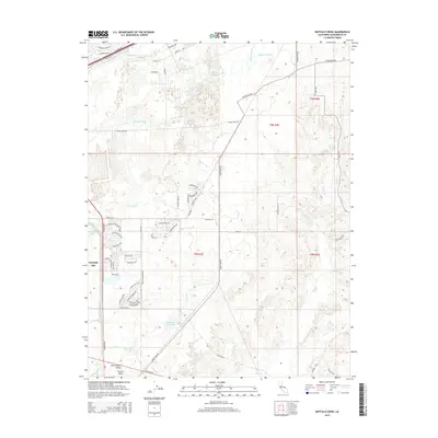
2015 Map of Buffalo Creek
USGS Topo · Published 2015About this map
Mather AFB and the surrounding eastern suburbs of the Sacramento Valley reveal a landscape defined by water management and rapid residential expansion. The presence of the Folsom South Canal and historical waterworks like Rebel Hill Ditch illustrate the complex irrigation and drainage systems required for this portion of the Central Valley. Modern subdivisions such as Anatolia Dr and the clusters of streets near Security Park Dr push into former ranch or open lands. Natural drainage is still visible through the meandering paths of Buffalo Creek and Laguna Cr, while Blodgett Reservoir and Mather Lake serve as key local catchments. This survey provides a precise look at the transition between established military aviation grounds and the mid-2010s residential growth patterns along the Grant Line Rd corridor.
Find a feature on this map
68 named features on this map. Tap any name to fly to it.
Don’t see what you’re looking for? This feature index may not catch every label — zoom into the map to look around manually.
Map Details
Editions of this 2015 Buffalo Creek Map
This is the sole edition of this map. No revisions or reprints were ever made.
Other maps of this area

1891 · Sacramento
USGS Topo · 1:125,000

1892 · Sacramento
USGS Topo · 1:125,000

1893 · Sacramento
USGS Topo · 1:125,000

1894 · Lodi
USGS Topo · 1:125,000

1902 · Fairoaks
USGS Topo · 1:62,500

1908 · Buffalo Creek
USGS Topo · 1:31,680

1909 · Elk Grove
USGS Topo · 1:31,680

1909 · Carbondale
USGS Topo · 1:31,680

1909 · Cosumnes
USGS Topo · 1:31,680

1911 · Mills
USGS Topo · 1:31,680