
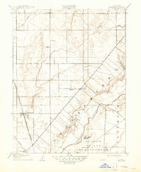
1909 Map of Elk Grove
USGS Topo · Published 1909About this map
Elk Grove and its surrounding agricultural landscape are defined by the convergence of early transportation corridors and several small rural education centers at the turn of the twentieth century. The Southern Pacific RR (Niles and Sacramento Line) cuts through the western portion of the sheet, providing a vital rail link that shaped the early development of this Sacramento County region. Further east, the village of Sheldon serves as a local hub near the meandering path of the Cosumnes River and its tributary, Deer Creek.
Find a feature on this map
15 named features on this map. Tap any name to fly to it.
Don’t see what you’re looking for? This feature index may not catch every label — zoom into the map to look around manually.
Map Details
Editions of this 1909 Elk Grove Map
2 editions found
Other maps of this area

1891 · Sacramento
USGS Topo · 1:125,000

1892 · Sacramento
USGS Topo · 1:125,000

1893 · Sacramento
USGS Topo · 1:125,000

1894 · Lodi
USGS Topo · 1:125,000

1902 · Fairoaks
USGS Topo · 1:62,500

1908 · Buffalo Creek
USGS Topo · 1:31,680

1909 · Clay
USGS Topo · 1:31,680

1909 · Cosumnes
USGS Topo · 1:31,680

1909 · Florin
USGS Topo · 1:31,680

1910 · Bruceville
USGS Topo · 1:31,680