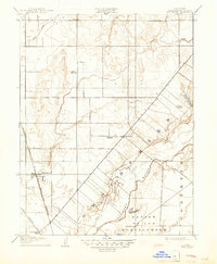
1909 Map of Elk Grove
USGS Topo · Published 1947About this map
Elk Grove and Sheldon anchor this early twentieth-century survey of the California Central Valley, depicting a landscape defined by ranching, early education, and the arrival of heavy rail. The Southern Pacific (Niles and Sacramento Line) cuts through the western edge of the quadrangle, signaling the area's transition toward a more connected agricultural economy. The southeastern portion of the map is dominated by the Cosumnes River and the meandering path of Deer Creek, which flow through the expansive San Jon De Los Moquelumnes land grant. Local genealogy and history are well-represented by a distinct network of rural schools, including the Reese School, Union School, Pleasant Grove School, Davis School, and San Joaquin School, which served the scattered farmstead families of the era. The presence of the Upper Stockton Road further illustrates the primary transit corridors used before the expansion of modern highways.
Find a feature on this map
13 named features on this map. Tap any name to fly to it.
Don’t see what you’re looking for? This feature index may not catch every label — zoom into the map to look around manually.
Map Details
Editions of this 1909 Elk Grove Map
2 editions found
Other maps of this area

1891 · Sacramento
USGS Topo · 1:125,000

1892 · Sacramento
USGS Topo · 1:125,000

1893 · Sacramento
USGS Topo · 1:125,000

1894 · Lodi
USGS Topo · 1:125,000

1902 · Fairoaks
USGS Topo · 1:62,500

1908 · Buffalo Creek
USGS Topo · 1:31,680

1909 · Elk Grove
USGS Topo · 1:31,680

1909 · Clay
USGS Topo · 1:31,680

1909 · Cosumnes
USGS Topo · 1:31,680

1909 · Florin
USGS Topo · 1:31,680