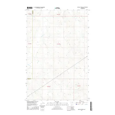
2017 Map of Buffalo Creek SE
USGS Topo · Published 2017About this map
The Redwater River winds through this sparsely settled corner of the Montana plains, defining a landscape carved by a network of seasonal watercourses. This area, located along the border of McCone and Dawson counties, is characterized by its wide drainage basins and a handful of section-line roads that facilitate ranching and land management. The presence of Duck Cr, Sullivan Cr, and Bluff Cr highlights the complex natural irrigation of the Missouri River watershed, where the terrain rises from the riverbanks into high, contoured plateaus. Local transport depends on a thin grid of routes including Duck Creek Rd and Rd 621, which connect the remote sections of this high-plains environment. The map provides a detailed view of the Public Land Survey System divisions, illustrating the geometric organization of the American West.
Find a feature on this map
17 named features on this map. Tap any name to fly to it.
Don’t see what you’re looking for? This feature index may not catch every label — zoom into the map to look around manually.
Map Details
Editions of this 2017 Buffalo Creek SE Map
This is the sole edition of this map. No revisions or reprints were ever made.
Other maps of this area

1954 · Glendive
USGS Topo · 1:250,000

1957 · Glendive
USGS Topo · 1:250,000

1958 · Glendive
USGS Topo · 1:250,000

1982 · Circle
USGS Topo · 1:100,000

1983 · Johnson Reservoir NW
USGS Topo · 1:24,000

1983 · Woodworth Hill
USGS Topo · 1:24,000

1983 · Buffalo Creek NE
USGS Topo · 1:24,000

1983 · Circle Reservoir
USGS Topo · 1:24,000

1983 · Buffalo Creek
USGS Topo · 1:24,000

1983 · Beery Reservoir
USGS Topo · 1:24,000