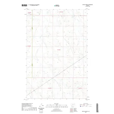
2020 Map of Buffalo Creek SE
USGS Topo · Published 2020About this map
The Redwater River winds through this section of the eastern Montana plains, marking a landscape defined by its intricate drainage systems and section line boundaries. This 2020 survey highlights the rural interface of the McCone Co and Dawson Co border, where the terrain is etched by numerous watercourses including Sullivan Creek, Bluff Cr, and Brush Cr. The map captures the specialized road network essential for ranching and land management in this region, featuring local routes such as Duck Creek Rd, Rd 617, and Rd 621. This documentation of the high plains topography provides an essential look at the physical geography of the area before modern changes, preserving the locations of seasonal creeks like Corral Cr and Duck Cr that have historically dictated the placement of homesteads and grazing routes.
Find a feature on this map
18 named features on this map. Tap any name to fly to it.
Don’t see what you’re looking for? This feature index may not catch every label — zoom into the map to look around manually.
Map Details
Editions of this 2020 Buffalo Creek SE Map
This is the sole edition of this map. No revisions or reprints were ever made.
Other maps of this area

1954 · Glendive
USGS Topo · 1:250,000

1957 · Glendive
USGS Topo · 1:250,000

1958 · Glendive
USGS Topo · 1:250,000

1982 · Circle
USGS Topo · 1:100,000

1983 · Johnson Reservoir NW
USGS Topo · 1:24,000

1983 · Woodworth Hill
USGS Topo · 1:24,000

1983 · Buffalo Creek NE
USGS Topo · 1:24,000

1983 · Circle Reservoir
USGS Topo · 1:24,000

1983 · Buffalo Creek
USGS Topo · 1:24,000

1983 · Beery Reservoir
USGS Topo · 1:24,000