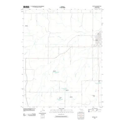
2010 Map of Buffalo
USGS Topo · Published 2010About this map
Buffalo serves as the focal point of this northwestern Oklahoma landscape, situated where the high plains are dissected by the meandering path of Buffalo Creek. The settlement pattern in 2010 follows a rigid section-line grid, typical of the late 19th-century land surveys, with roads like N1900 Rd and E0160 Rd providing access to the surrounding agricultural terrain. A significant hydrological feature of the area is the collection of engineered water management sites, including the Oknoname 059062 Reservoir and the R Wickham Number 4 Dam, reflecting the region's reliance on water conservation. These small-scale reservoirs and dams, often named for local landowners or designated by state inventory numbers, dot the drainage basins of Rodkeys Creek and other smaller tributaries, illustrating the local adaptations required for prairie life.
Find a feature on this map
27 named features on this map. Tap any name to fly to it.
Don’t see what you’re looking for? This feature index may not catch every label — zoom into the map to look around manually.
Map Details
Editions of this 2010 Buffalo Map
This is the sole edition of this map. No revisions or reprints were ever made.
Other maps of this area

1955 · Woodward
USGS Topo · 1:250,000

1958 · Woodward
USGS Topo · 1:250,000

1970 · Buffalo SE
USGS Topo · 1:24,000

1970 · Buffalo NW
USGS Topo · 1:24,000

1970 · Rosston NE
USGS Topo · 1:24,000

1970 · Buffalo NE
USGS Topo · 1:24,000

1970 · Buffalo
USGS Topo · 1:24,000

1971 · Rosston SE
USGS Topo · 1:24,000

1971 · Fort Supply NW
USGS Topo · 1:24,000

1971 · Fort Supply NE
USGS Topo · 1:24,000