
1971 Map of Fort Supply NW
USGS Topo · Published 1973About this map
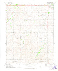
The And Gas Field dominates the northern landscape of this Harper County region, characterized by an extensive network of Gas Wells and connecting pipelines. This industrial footprint sits atop a terrain defined by subtle water features, where Sand Creek and scattered Springs provide a stark contrast to the petroleum infrastructure. The southern portion of the map transitions toward the Beaver R, showing a mix of resource extraction and local utility landmarks like a Substation and a Townhall. The distribution of Gravel Pits and numerous Drill Holes suggests an era of active geological exploration and road maintenance. Small touches of public infrastructure, such as the Roadside Park near the eastern border, offer a sense of the mid-century traveling experience across the Oklahoma panhandle's edge.
Find a feature on this map
17 named features on this map. Tap any name to fly to it.
Don’t see what you’re looking for? This feature index may not catch every label — zoom into the map to look around manually.
Map Details
Editions of this 1971 Fort Supply NW Map
This is the sole edition of this map. No revisions or reprints were ever made.
Other maps of this area

1955 · Woodward
USGS Topo · 1:250,000

1958 · Woodward
USGS Topo · 1:250,000

1970 · Buffalo SE
USGS Topo · 1:24,000

1970 · Buffalo
USGS Topo · 1:24,000

1971 · Rosston SE
USGS Topo · 1:24,000

1971 · May East
USGS Topo · 1:24,000

1971 · Fort Supply
USGS Topo · 1:24,000

1971 · Fort Supply NE
USGS Topo · 1:24,000

1971 · Laverne NE
USGS Topo · 1:24,000
1971 · May West
USGS Topo · 1:24,000