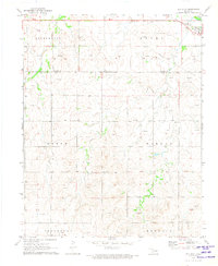
1971 Map of May West
USGS Topo · Published 1973About this map
The northern edge of Ellis County and southern border of Harper County meet in this 1970s survey, capturing the agricultural and energy-driven landscape of the Oklahoma Panhandle region. The small settlement of May serves as a primary local hub, positioned along the M-K-T railroad line. This rail corridor follows the natural drainage of Otter Creek, which flows southeast across the plains. The map illustrates a high density of industrial activity with dozens of individually marked gas wells, a Gravel Pit, and a Drill Hole scattered throughout the townships.
Find a feature on this map
14 named features on this map. Tap any name to fly to it.
Don’t see what you’re looking for? This feature index may not catch every label — zoom into the map to look around manually.
Map Details
Editions of this 1971 May West Map
This is the sole edition of this map. No revisions or reprints were ever made.
Other maps of this area

1955 · Woodward
USGS Topo · 1:250,000

1958 · Woodward
USGS Topo · 1:250,000

1969 · Fargo NW
USGS Topo · 1:24,000

1969 · Shattuck NW
USGS Topo · 1:24,000

1969 · Shattuck NE
USGS Topo · 1:24,000

1970 · Laverne SW
USGS Topo · 1:24,000

1971 · May East
USGS Topo · 1:24,000

1971 · Fort Supply NW
USGS Topo · 1:24,000
1971 · Laverne
USGS Topo · 1:24,000

1971 · Laverne NE
USGS Topo · 1:24,000