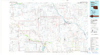
1985 Map of Buffalo
USGS Topo · Published 1985About this map
The Beaver River and Cimarron River cut through the high plains of the Oklahoma Panhandle region, anchoring a landscape of ranching and early energy extraction. In the mid-1980s, the area around Buffalo and Laverne was defined by its expansive drainage networks, including Snake Creek and Willow Creek, alongside specialized infrastructure like the Aqueduct and various irrigation ditches. The southeastern portion of the map highlights unique geological and recreational features, specifically the subterranean depths of Alabaster Caverns and the adjacent Alabaster Caverns State Park.
Find a feature on this map
49 named features on this map. Tap any name to fly to it.
Don’t see what you’re looking for? This feature index may not catch every label — zoom into the map to look around manually.
Map Details
Editions of this 1985 Buffalo Map
2 editions found
Other maps of this area

1891 · Medicine Lodge
USGS Topo · 1:125,000

1892 · Meade
USGS Topo · 1:125,000

1892 · Coldwater
USGS Topo · 1:125,000

1893 · Medicine Lodge
USGS Topo · 1:125,000

1894 · Sitka
USGS Topo · 1:62,500

1896 · Ashland
USGS Topo · 1:125,000

1954 · Perryton
USGS Topo · 1:250,000

1955 · Woodward
USGS Topo · 1:250,000

1955 · Pratt
USGS Topo · 1:250,000

1955 · Dodge City
USGS Topo · 1:250,000