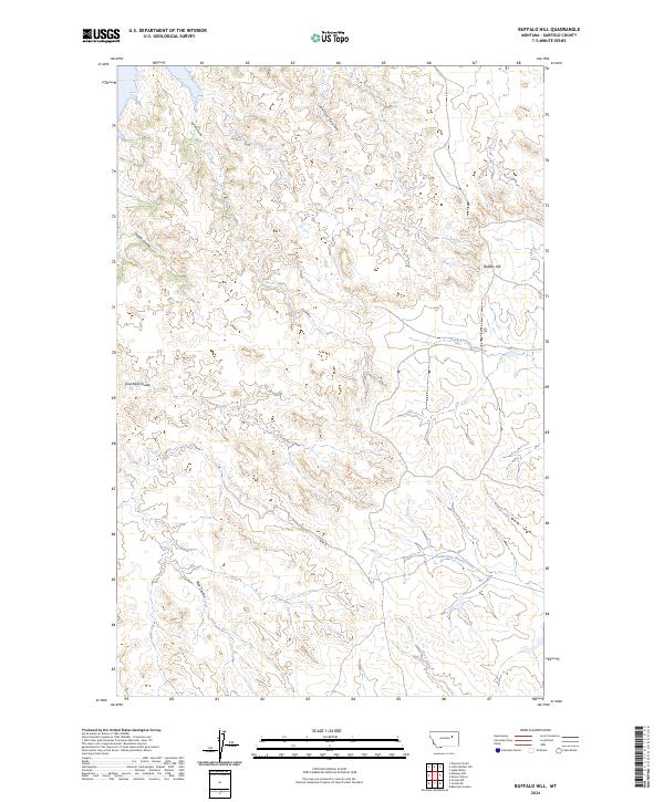
2024 Map of Buffalo Hill
USGS Topo · Published 2024About this map
Charles M Russell National Wildlife Refuge encompasses a significant portion of this Garfield County landscape, where the breaks and drainages flow toward the Missouri River system. The terrain is defined by a dense network of coulees, including Burdick Coulee and Jasper Coulee, which carve through the high plains. Central to the area is Buffalo Hill, a prominent landmark that overlooks the surrounding prairie. This 2024 survey documents the hydrography of the region's intermittent streams, such as the North Fork Woody Creek and South Fork Woody Creek, which gather in the eastern portion of the quadrangle. The lack of modern development reflects the remote character of this protected wilderness area, highlighting the intricate natural topography of Wolf Creek and the various Ried Coulee branches that shape the southern reach of the map.
Find a feature on this map
16 named features on this map. Tap any name to fly to it.
Don’t see what you’re looking for? This feature index may not catch every label — zoom into the map to look around manually.
Map Details
Editions of this 2024 Buffalo Hill Map
This is the sole edition of this map. No revisions or reprints were ever made.
Other maps of this area

1954 · Jordan
USGS Topo · 1:250,000

1956 · Jordan
USGS Topo · 1:250,000

1958 · Jordan
USGS Topo · 1:250,000

1958 · Maloney Hill
USGS Topo · 1:62,500

1964 · Jordan
USGS Topo · 1:250,000

1964 · Jordan NE
USGS Topo · 1:24,000

1964 · Bateman Coulee
USGS Topo · 1:24,000

1964 · Jordan NW
USGS Topo · 1:24,000
1972 · Kester School
USGS Topo · 1:24,000
1972 · Signal Butte
USGS Topo · 1:24,000